Surrogate City Finder
Surrogate City Finder
Web address: cityfinder.cbs.iiit.ac.in
The need of accurate weather data for building simulations has been well recognized over the years. However, for many locations around the world, there is no weather data readily available for use in building simulation. While local knowledge can sometimes aid in the selection of appropriate weather data for a specific site, this is not always sufficient or known. When the location in question does not have readily available weather data, it is a common practice to choose the available weather file, which is nearest to the required location. In many cases, the climates of both the locations could be very different. For example, Lonavala (a hill station near Pune, India) has the nearest available weather data file of Pune, but both the climates are quite different. Using such a weather file would give inaccurate results.
Description
The Surrogate City Finder Tool is easy to use web based tool that can be used by building energy simulation professionals, researchers, HVAC designers etc.
Input parameters
- Location
- Latitude range
- Altitude range
- Temperature range
- Distance range
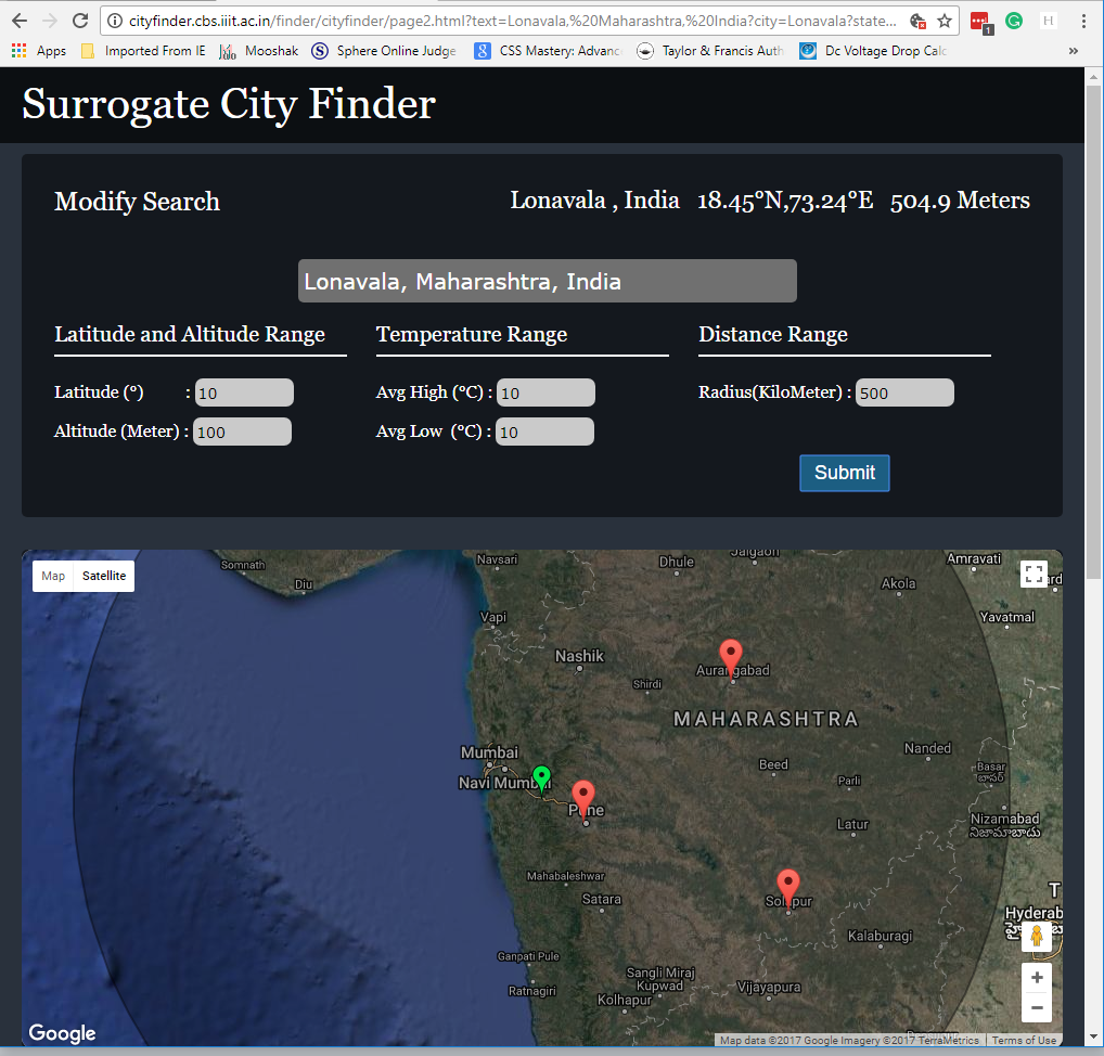
Based on the name of the location, the details of the latitude, longitude, altitude, average temperature values are extracted from Wikipedia. This extraction is done by parsing the page source. These values are then compared to all the weather data files available in the world. There are various filters that facilitate the user to narrow down the data files by specific latitude range, altitude range, temperature difference and distance from the required location. The tool identifies various locations that match the weather of the location and perform a quick check on the degree with which it matches various weather data files available within a specified range and shortlists the best possible matches.
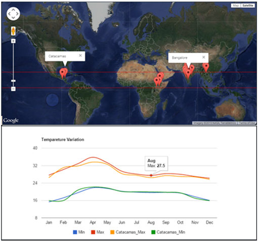
The tool also allows the user to see the temperature variation profile of the average maximum and average minimum temperatures for all the months in a year for both the cities. Root Mean Square (RMS) error is calculated for the input city and all the available cities, and then the cities with the minimum RMS error are shortlisted.
The user has the advantage to choose from the shortlisted weather files that closely matches the required location.
An interactive google map interface displays the input location along with the surrogate cities that have the nearest weather data. The tool also displays a graph showing the temperature variation between the required location and its surrogate city. By comparing the graphs of the input location with the same graph of the shortlisted locations, the user can gain a quick understanding of the differences between the two locations as shown in Figure 3-8.
System Interface
SCF has been developed on Ubuntu platform using Python language. Python uses ‘Mechanize’ for navigation, ‘Beautiful Soup’ to get weather files data from EnergyPlus weather data link and web services are used to call the API for capturing values such as humidity and temperature. The web application is hosted on a Linux server connecting to a database server.
Dependencies
The correct functioning of SCF tool will partly be dependent on the availability and correctness of the data retrieved from Wikipedia (Wikipedia, the Free Encyclopedia) and also the accuracy of the available energy plus weather files.